

File:Scotland from the Matthew Paris map, c.1250.jpg
Scotland_from_the_Matthew_Paris_map,_c.1250.jpg (522 × 399 pixels, file size: 103 KB, MIME type: image/jpeg)
| |
This is a file from the Wikimedia Commons. Information from its description page there is shown below.
Commons is a freely licensed media file repository. You can help. |
Contents |
Summary
| Description |
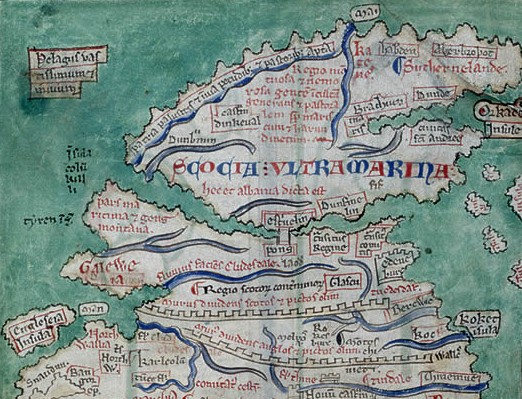
English: Scotland Beyond The Sea: a detail from the Matthew Paris map of Britain, c.1250 The Scottish heartland (Alba) is perceived as almost a separate island above the Rivers Forth and Clyde, reached by Stirling Bridge. Mediaeval English chroniclers refer to the Firth of Forth as 'the Scottish Sea' (This image is annotated on its description page). |
|||||||||||||||||||||||
| Date | 30 August 2011 | |||||||||||||||||||||||
| Source | British Library | |||||||||||||||||||||||
| Author |
|
|||||||||||||||||||||||
Licensing
 |
This work is in the public domain in the United States, and those countries with a copyright term of life of the author plus 100 years or less. |
|
|
|
| Annotations | This image is annotated: View the annotations at Commons |
![]() The categories of this image should be checked. Check them now!
The categories of this image should be checked. Check them now!
- Remove redundant categories and try to put this image in the most specific category/categories
- Remove this template by clicking here (or on the first line)
File usage on other wikis
Related galleries
File usage
The following pages on Schools Wikipedia link to this image (list may be incomplete):
Learn more
Through Schools Wikipedia, SOS Children has brought learning to children around the world. SOS Children's Villages believes education is an important part of a child's life. That's why we ensure they receive nursery care as well as high-quality primary and secondary education. When they leave school, we support the children in our care as they progress to vocational training or higher education. Have you thought about sponsoring a child?