|
This is a file from the Wikimedia Commons. Information from its description page there is shown below.
Commons is a freely licensed media file repository. You can help.
|
Summary
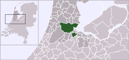
| DescriptionLocatieAmsterdam.svg |
Locator map of municipality Amsterdam (NL)
|
| Date |
2 October 2006 |
| Source |
Own work, based on freely available GIS data |
| Author |
User:Mtcv |
Permission
( Reusing this file) |
Data: attribution required; my work: PD
|
Licensing
 |
The copyright holder of this file, Centraal Bureau voor de Statistiek, allows anyone to use it for any purpose, provided that the copyright holder is properly attributed. Redistribution, derivative work, commercial use, and all other use is permitted. |
| Attribution: Centraal Bureau voor de Statistiek Attribution
|

|
The permission to use this work has been archived in the Wikimedia OTRS system. It is available as ticket #2007041210008226 for users with an OTRS account. If you wish to reuse this work elsewhere, please read the instructions at COM:REUSE. If you are a Commons user and wish to confirm the permission, please leave a note at the OTRS noticeboard. Ticket link: https://ticket.wikimedia.org/otrs/index.pl?Action=AgentTicketZoom&TicketNumber=2007041210008226
|
| This image is (in part or entirely) based on geographical data from Statistics Netherlands (Centraal Bureau voor de Statistiek). Digital geometry files in ESRI format can be downloaded from their website . In particular, boundary data of statistical districts is based on either the Wijk- en buurtkaart 2005, or the Wijk- en buurtkaart 2003 ("CBS/TOPgrenzen"). Data on localities (bevolkingskernen) are from the publication Bevolkingskernen in Nederland 2001.
Conditions of use (in Dutch):
- Bij visualisering van gegevens met behulp van het digitale bestand Wijk- en buurtkaart 2005 dient te worden vermeld:
- Bron: © 2006, Centraal Bureau voor de Statistiek / Topografische Dienst Kadaster
- Bij visualisering van gegevens met behulp van het digitale bestand CBS/TOPgrenzen dient te worden vermeld:
- Grenzen ondergrond: © 2003, Centraal Bureau voor de Statistiek/Topografische Dienst Kadaster
- Bij visualisering van gegevens met behulp van het digitale bestand "Bevolkingskernen 2001" dient te worden vermeld:
- Bron: © 2005, Centraal Bureau voor de Statistiek
Unless otherwise specified, data on waterways and lakes are from the public domain Digital Chart of the World.
|
File usage
The following pages on Schools Wikipedia link to this image (list may be incomplete):
This file contains additional information, probably added from the digital camera or scanner used to create or digitize it. If the file has been modified from its original state, some details may not fully reflect the modified file.
Schools Wikipedia was created by children's charity SOS Children. SOS Childrens Villages helps more than 2 million people across 133 countries around the world. Try to find out how you can help children in other countries on our web site.