

File:Europe under Nazi domination.png
Size of this preview: 523 × 480 pixels.
| |
This is a file from the Wikimedia Commons. Information from its description page there is shown below.
Commons is a freely licensed media file repository. You can help. |
 |
This map image could be recreated using vector graphics as an SVG file. This has several advantages; see Commons:Media for cleanup for more information. If an SVG form of this image is already available, please upload it. After uploading an SVG, replace this template with {{ vector version available|new image name.svg}}. |
Summary
| Description |
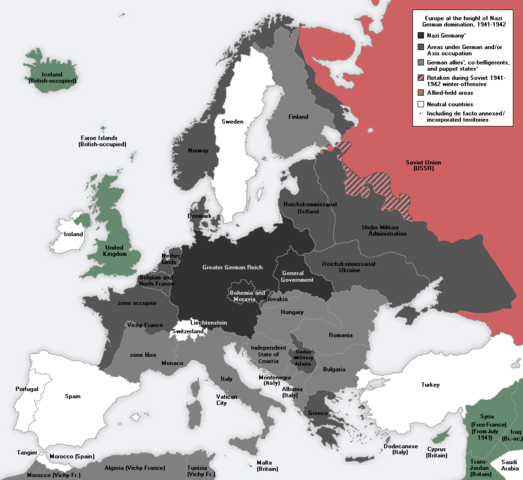
English: Europe at the height of the WWII Axis military conquests in 1941–1942.
中文: 1941至42年二戰期間,軸心國的軍事佔領達至高峰時的歐洲。
|
| Date | 16 March 2011 |
| Source | Own work |
| Author | Morgan Hauser, derived from File:Second world war europe 1943-1945 map en.png and File:Second world war europe 1941-1942 map en.png by users Jarry1250 and ArmadniGeneral, respectively. |
| Permission ( Reusing this file) |
See Licensing below. |
Licensing
|
File usage
The following pages on Schools Wikipedia link to this image (list may be incomplete):
Metadata
Schools Wikipedia and SOS Children
Wikipedia for Schools is one of SOS Children's many educational projects. Thanks to SOS Children, 62,000 children are enjoying a happy childhood, with a healthy, prosperous future ahead of them. We have helped children in Africa for many years - you can help too...