

File:Mobile phone map 1980-2009.gif
Size of this preview: 640 × 287 pixels.
| |
This is a file from the Wikimedia Commons. Information from its description page there is shown below.
Commons is a freely licensed media file repository. You can help. |
Summary
| Description |
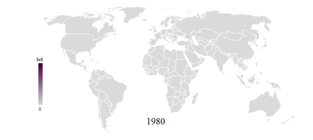
English: Political world map shaded according to the number of cell phone(mobile)subscriptions in each country and spanning the years 1980-2009. Data is from Mathematica CountryData ( http://reference.wolfram.com/mathematica/note/CountryDataSourceInformation.html).
|
| Date | 15 September 2011 |
| Source | Own work |
| Author | Michael Hale |
Licensing
|
File usage
The following pages on Schools Wikipedia link to this image (list may be incomplete):
Wikipedia for Schools...
SOS Children has brought Wikipedia to the classroom. SOS Children helps those who have nothing and no one, giving them back the famly they have lost and bringing them the very best opportunities for a happy, healthy future. Sponsoring a child is a great way to help children who need your support.