

File:Central Asia - political map 2008.svg
Size of this preview: 605 × 480 pixels.
| |
This is a file from the Wikimedia Commons. Information from its description page there is shown below.
Commons is a freely licensed media file repository. You can help. |
| Description |
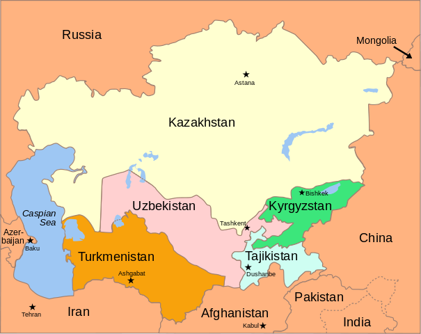
Political Map of the Caucasus and Central Asia, 2008 |
| Date | 5 October 2008 |
| Source |
|
| Author |
|
| Permission ( Reusing this file) |
see below |
| This file is licensed under the Creative Commons Attribution-Share Alike 3.0 Unported license. | ||
|
| |
This SVG file uses embedded text that can be easily translated into your language using this automated tool. Learn more. You can also download it and translate it manually using a text editor.
|
File usage
The following pages on Schools Wikipedia link to this image (list may be incomplete):
Metadata
I want to learn more...
SOS Children's Villages chose the best bits of Wikipedia to help you learn. SOS Children's Villages helps more than 2 million people across 133 countries around the world. There are many ways to help with SOS Childrens Villages.