

File:HongKong boundary from space.png
Size of this preview: 640 × 414 pixels.
| |
This is a file from the Wikimedia Commons. Information from its description page there is shown below.
Commons is a freely licensed media file repository. You can help. |
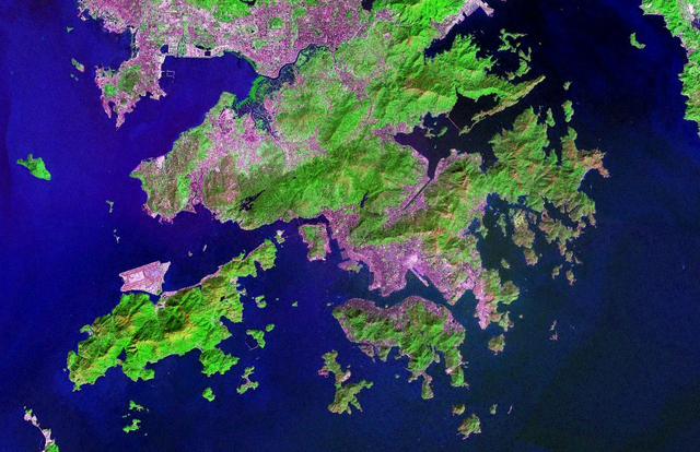
| Description | Satellite Image of Hong Kong. Urban areas are in pink, vegetation is in green. | |||
| Date | 07:20, 5 November 2006 (UTC) | |||
| Source | NASA World Wind Software | |||
| Author | NASA | |||
| Permission ( Reusing this file) |
|

 |
This image, which was originally uploaded with an assertion of Public Domain status, was reviewed on 12 February 2010 by the administrator or trusted user Rambo's Revenge (en.wiki), who confirmed the Public Domain status on that date. |
File usage
The following pages on Schools Wikipedia link to this image (list may be incomplete):
Did you know...?
Schools Wikipedia was created by children's charity SOS Children. SOS Childrens Villages is famous for the love and shelter it brings to lone children, but we also support families in the areas around our Children's Villages, helping those who need us the most. There are many ways to help with SOS Children's Villages.