

File:Katrina-noaaGOES12.jpg
Size of this preview: 640 × 400 pixels.
| |
This is a file from the Wikimedia Commons. Information from its description page there is shown below.
Commons is a freely licensed media file repository. You can help. |
| This image appeared on Wikipedia's Main Page in the Did you know? column on 21 July 2006. |
|
| Description |
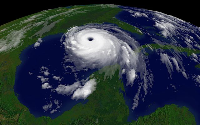
Courtesy NOAA/NESDIS: http://www.nnvl.noaa.gov/ 2005/08/28T1515Z |
||||
| Date | 28 August 2005 | ||||
| Source | http://www.nnvl.noaa.gov/hurseas2005/Katrina1515z-050828-4kg12.jpg as linked by http://www.nnvl.noaa.gov/cgi-bin/index.cgi?page=items&ser=109660&large=1 | ||||
| Author | NOAA |
 |
This image is in the public domain because it contains materials that originally came from the U.S. National Oceanic and Atmospheric Administration, taken or made as part of an employee's official duties.
|
 |
File usage
The following pages on Schools Wikipedia link to this image (list may be incomplete):
Metadata
What is Schools Wikipedia?
SOS Childrens Villages aims to make Wikipedia suitable for young learners. SOS Children is there for the children in our care until they are ready for independence. Would you like to sponsor a child?