

File:PostVeniceLG.jpg
PostVeniceLG.jpg (600 × 399 pixels, file size: 48 KB, MIME type: image/jpeg)
| |
This is a file from the Wikimedia Commons. Information from its description page there is shown below.
Commons is a freely licensed media file repository. You can help. |
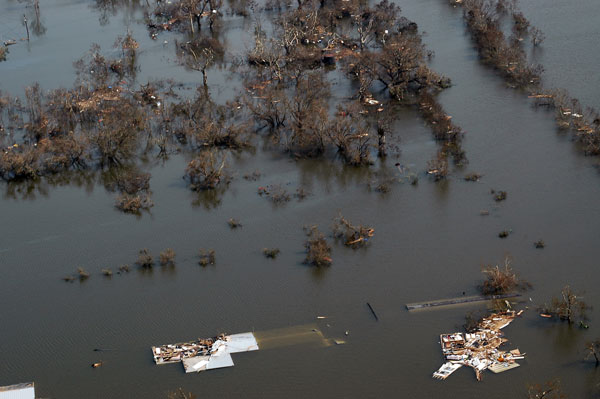
| Description | Flooding in Venice, Louisiana after Hurricane Katrina. Part of Venice, LA, on August 30, 2005. The southernmost permanently inhabited area on the Louisiana coast, Venice is located within a ring levee on the Mississippi River. The levee was ineffective during Hurricane Katrina. The entire town was flooded, oil-field vessels and barges were strewn haphazardly, and huge deposits of wrack were left on both sides of the ring levee on the west side of town. | |||
| Date | 30 August 2005 | |||
| Source | http://soundwaves.usgs.gov/2005/09/ | |||
| Author | User Storm05 on en.wikipedia | |||
| Permission ( Reusing this file) |
|

File usage
The following pages on Schools Wikipedia link to this image (list may be incomplete):
Learn more about Schools Wikipedia
Wikipedia for Schools is one of SOS Childrens Villages' many educational projects. SOS Children's Villages is an international children's charity, providing a good home and loving family to thousands of children who have lost their parents. We also work with communities to help vulnerable families stay together and raise children in the best possible environment. Why not try to learn more about child sponsorship?