

File:Northern segment of the second Tay Bridge.jpg
Size of this preview: 638 × 104 pixels.
| |
This is a file from the Wikimedia Commons. Information from its description page there is shown below.
Commons is a freely licensed media file repository. You can help. |
Summary
|
Camera location |
|
This and other images at their locations on: Google Maps - Google Earth - OpenStreetMap | ( Info) |
|---|
| Description |
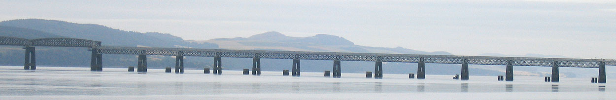
English: This is a northern segment of the second Tay Bridge, showing a section from the High Girders on the left, to the beginning of a shallower span on the right. The image also shows examples of the stumps of the first Tay Bridge poking out of the Tay.
|
| Date | 9 August 2005 |
| Source | Own work |
| Author | Denimadept |
Licensing
|
File usage
The following pages on Schools Wikipedia link to this image (list may be incomplete):
Metadata
Learn more
SOS Children's Villages aims to make Wikipedia suitable for young learners. SOS Childrens Villages cares for children who have lost their parents. Our Children's Villages give these children a new home and a new family, while a high-quality education and the best of medical care ensures they will grow up with all they need to succeed in adult life. Sponsoring a child is a great way to help children who need your support.