

File:Antarctica, Australia territorial claim.svg
Size of this preview: 480 × 480 pixels.
| |
This is a file from the Wikimedia Commons. Information from its description page there is shown below.
Commons is a freely licensed media file repository. You can help. |
| Description |
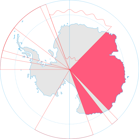
English: Map showing the territorial claim to Antarctica by the country in the filename. Also on the map are is the 60° S Parallel, Antarctic Circle, 0/180 latitude line and (in red) the borders of the claims by other states.
|
|||||
| Date | 30 June 2008 | |||||
| Source | Generated from Antarctica by Lokal_Profil. | |||||
| Author | Lokal_Profil | |||||
| Permission ( Reusing this file) |
|
File usage
The following pages on Schools Wikipedia link to this image (list may be incomplete):
Metadata
What is Schools Wikipedia?
SOS Children's Villages chose the best bits of Wikipedia to help you learn. SOS Childrens Villages is a global charity founded in 1949 to give children who have lost everything the childhood they deserve. Try to find out how you can help children in other countries on our web site.