

File:Weimar Republic 1930.svg
| |
This is a file from the Wikimedia Commons. Information from its description page there is shown below.
Commons is a freely licensed media file repository. You can help. |
Contents
|
Summary
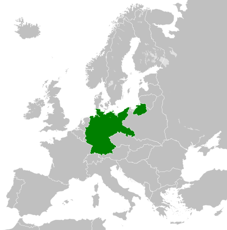
| Description | Deutsch: Karte der Weimarer Republik/Deutsches Reich innerhalb Europa, ca. 1930
English: Map of the Weimar Republic within Europe circa 1930.
Українська: Карта Веймарської республіки в Європі, 1930 рік.
|
| Date | 2011-10-27 02:10 (UTC) |
| Source |
|
| Author |
|
Licensing
| This file is licensed under the Creative Commons Attribution-Share Alike 3.0 Unported license. | ||
|
File usage
The following pages on Schools Wikipedia link to this image (list may be incomplete):
Metadata
Learn more about Schools Wikipedia
SOS Children's Villages has brought Wikipedia to the classroom. SOS Children helps those who have nothing and no one, giving them back the famly they have lost and bringing them the very best opportunities for a happy, healthy future. Have you thought about sponsoring a child?