

File:Tettstedet Oslo 2005.png
Size of this preview: 640 × 366 pixels.
| |
This is a file from the Wikimedia Commons. Information from its description page there is shown below.
Commons is a freely licensed media file repository. You can help. |
Summary
| Description |
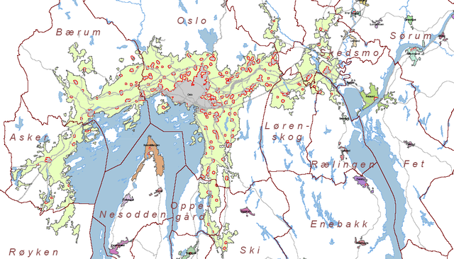
Map of tettstedet Oslo made by Statistisk Sentralbyrå based on data of 01.01.2005. |
| Date | 2005 |
| Source | http://www.ssb.no/emner/01/01/20/tettstedkart/fylke0203.pdf |
| Author | Statistisk sentralbyrå (Statistics Norway). |
| Permission ( Reusing this file) |
Statistics Norway freely permits saving, printing, copying and spreading of the material on this web site (text, tables and figures). Statistics Norway must be credited when using the material. ( |
Norsk bokmål: Kilde: Statistisk sentralbyrå. Kartet er beskåret av meg.
Bruk av SSBs materiale:
Statistisk sentralbyrå gir tillatelse til at materiale på dette nettstedet (tekst, statistiske tabeller og figurer) fritt kan lagres elektronisk, skrives ut, mangfoldiggjøres og videreformidles. Tillatelsen forutsetter henvisning til kilden stoffet er hentet fra (kilde: Statistisk sentralbyrå). Kildehenvisning skal angis i direkte tilknytning til hver tabell og figur som benyttes. (Tatt fra )
English: Source: Statistics Norway. The map is cropped by me, Jorunn.
Using Statistics Norways material:
Statistics Norway freely permits saving, printing, copying and spreading of the material on this web site (text, tables and figures). Statistics Norway must be credited when using the material. (Translation of )Licensing
 |
The copyright holder of this file allows anyone to use it for any purpose, provided that the copyright holder is properly attributed. Redistribution, derivative work, commercial use, and all other use is permitted. |
|
|
File usage
The following pages on Schools Wikipedia link to this image (list may be incomplete):
Learn more
All five editions of Schools Wikipedia were compiled by SOS Children's Villages. SOS Children is a global charity founded in 1949 to give children who have lost everything the childhood they deserve. Why not try to learn more about child sponsorship?