

File:TchoutacabouffaRiver1998.jpg
| |
This is a file from the Wikimedia Commons. Information from its description page there is shown below.
Commons is a freely licensed media file repository. You can help. |
Summary
| Description |
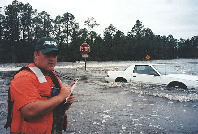
D'Iberville, Mississippi. Water flowing over Mississippi Highway 67 and Mississippi Highway 15 near their intersection during the September 1998 flooding caused on the Tchoutacabouffa River by Hurricane Georges. |
| Date | 29 September 1998 |
| Source | USGS Surface Water Photo Gallery: item 17 11 |
| Author | Trent Baldwin (submitted by Van Wilson, Mississippi) |
| Permission ( Reusing this file) |
Public Domain |
|
Camera location |
|
View this and other nearby images on: Google Maps - Google Earth - OpenStreetMap | ( Info) |
|---|
Licensing
 |
This image is in the public domain because it contains materials that originally came from the United States Geological Survey, an agency of the United States Department of the Interior. For more information, see the official USGS copyright policy. български | català | Deutsch | English | español | eesti | suomi | français | galego | italiano | 한국어 | македонски | മലയാളം | Nederlands | polski | português | русский | Türkçe | 中文 | 中文(简体) | +/− |
|
Transwiki trivia
An unoriginal Wikipedia description page is/was here. All following user names refer to en.wikipedia.
- 22:28, September 3, 2008 Suntag (34 bytes)
File usage
Learn more about Schools Wikipedia
SOS Childrens Villages has brought Wikipedia to the classroom. SOS Children is famous for the love and shelter it brings to lone children, but we also support families in the areas around our Children's Villages, helping those who need us the most. Why not try to learn more about child sponsorship?