

File:LocationWesternAfrica.png
LocationWesternAfrica.png (360 × 392 pixels, file size: 13 KB, MIME type: image/png)
| |
This is a file from the Wikimedia Commons. Information from its description page there is shown below.
Commons is a freely licensed media file repository. You can help. |
Summary
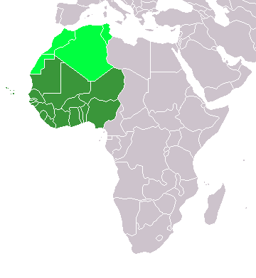
Map: Africa – Western Africa:
- dark green: UN subregion
- light green: Maghreb ( northwest Africa) – geographic
and also the other countries that the authour of the countriies in west africa didnt mention were libiya and pakistan and somalia and Togo plus Niger(land)
Licensing
 |
I, the copyright holder of this work, release this work into the public domain. This applies worldwide. In some countries this may not be legally possible; if so: I grant anyone the right to use this work for any purpose, without any conditions, unless such conditions are required by law.
|
File usage
The following pages on Schools Wikipedia link to this image (list may be incomplete):
What is Schools Wikipedia?
Schools Wikipedia was created by children's charity SOS Children's Villages. Thanks to SOS Childrens Villages, 62,000 children are enjoying a happy childhood, with a healthy, prosperous future ahead of them. We have helped children in Africa for many years - you can help too...