

File:Location of the British Indian Ocean Territory.png
Location_of_the_British_Indian_Ocean_Territory.png (191 × 95 pixels, file size: 5 KB, MIME type: image/png)
| |
This is a file from the Wikimedia Commons. Information from its description page there is shown below.
Commons is a freely licensed media file repository. You can help. |
 |
This map image could be recreated using vector graphics as an SVG file. This has several advantages; see Commons:Media for cleanup for more information. If an SVG form of this image is already available, please upload it. After uploading an SVG, replace this template with {{ vector version available|new image name.svg}}. |
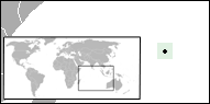
| Description | English: A locator map for the British Indian Ocean Territory (BIOT). The world map inset is from Image:Christmasisland.png; the dot is from Image:BlankMap-World-v6.png. The map is PD. move approved by: User:ChristianBier
|
||
| Date | 29 June 2007 | ||
| Source | This image was moved from Image:LocationBIOT.png | ||
| Author | User:Hoshie | ||
| Permission ( Reusing this file) |
|

File usage
The following pages on Schools Wikipedia link to this image (list may be incomplete):
Find out more
Wikipedia for Schools is one of SOS Children's Villages' many educational projects. More than 2 million people benefit from the global charity work of SOS Children's Villages, and our work in 133 countries around the world is vital to ensuring a better future for vulnerable children. Sponsoring a child is the coolest way to help.