

File:Abbasids850.png
Size of this preview: 640 × 390 pixels.
| |
This is a file from the Wikimedia Commons. Information from its description page there is shown below.
Commons is a freely licensed media file repository. You can help. |
Summary
| Description |
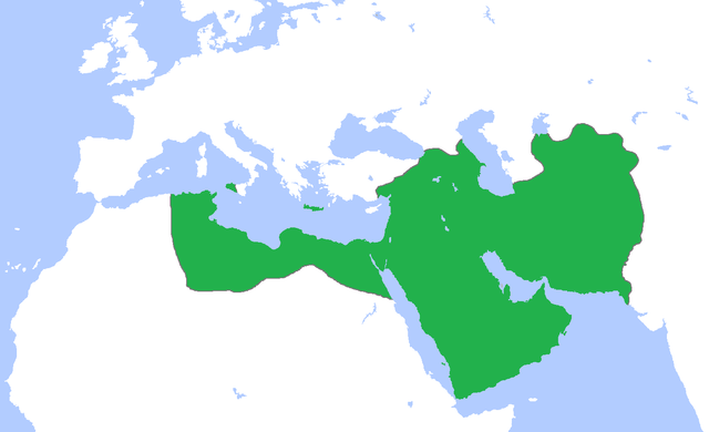
English: Map of the Abbasid Caliphate at its greatest extent, c. 850. (Partially based on Atlas of World History (2007) - Progress of Islam, map)
|
| Date | 21 April 2009 |
| Source | Own work |
| Author | Gabagool |
Licensing
|
File usage
The following pages on Schools Wikipedia link to this image (list may be incomplete):
Learn more about Schools Wikipedia
SOS Childrens Villages chose the best bits of Wikipedia to help you learn. SOS Children is an international children's charity, providing a good home and loving family to thousands of children who have lost their parents. We also work with communities to help vulnerable families stay together and raise children in the best possible environment. Help another child by taking out a sponsorship.