

Saint Vincent and the Grenadines
Background Information
This wikipedia selection has been chosen by volunteers helping SOS Children from Wikipedia for this Wikipedia Selection for schools. With SOS Children you can choose to sponsor children in over a hundred countries
| Saint Vincent and the Grenadines | ||||||
|---|---|---|---|---|---|---|
|
||||||
| Motto: "Pax et Justitia" (Latin) "Peace and Justice" |
||||||
| Anthem: Saint Vincent Land so Beautiful | ||||||
 |
||||||
| Capital and largest city |
Kingstown 13°10′N 61°14′W |
|||||
| Official languages | English | |||||
| Ethnic groups |
|
|||||
| Demonym | Vincentian | |||||
| Government | Parliamentary democracy under constitutional monarchy | |||||
| - | Monarch | Elizabeth II | ||||
| - | Governor-General | Sir Frederick Ballantyne | ||||
| - | Prime Minister | Ralph Gonsalves | ||||
| Legislature | House of Assembly | |||||
| Independence | ||||||
| - | from the United Kingdom | 27 October 1979 | ||||
| Area | ||||||
| - | Total | 389 km2 ( 198th) 150 sq mi |
||||
| - | Water (%) | negligible | ||||
| Population | ||||||
| - | 2008 estimate | 120,000 ( 182nd) | ||||
| - | Density | 307/km2 ( 39th) 792/sq mi |
||||
| GDP ( PPP) | 2011 estimate | |||||
| - | Total | $1.259 billion | ||||
| - | Per capita | $11,700 | ||||
| GDP (nominal) | 2011 estimate | |||||
| - | Total | $695 million | ||||
| - | Per capita | $6,342 | ||||
| HDI (2007) | high · 91st |
|||||
| Currency | East Caribbean dollar ( XCD) |
|||||
| Time zone | ( UTC-4) | |||||
| Drives on the | left | |||||
| Calling code | +1 784 | |||||
| ISO 3166 code | VC | |||||
| Internet TLD | .vc | |||||


Saint Vincent and the Grenadines ( / s eɪ n t ˈ v ɪ n s ə n t æ n d ð ə ɡ r ɛ n ə ˈ d iː n z /) is an island country in the Lesser Antilles chain, in the southern portion of the Windward Islands, which lie at the southern end of the eastern border of the Caribbean Sea where the latter meets the Atlantic Ocean.
Its 389 km2 (150 sq mi) territory consists of the main island of Saint Vincent and the northern two-thirds of the Grenadines, which are a chain of smaller islands stretching south from Saint Vincent Island to Grenada. The main island of Saint Vincent measures 18 km (11 mi) long, 11 km (6.8 mi) in width and 344 km2 (133 sq mi) in area. From the most northern to the most southern points, the Grenadine islands belonging to Saint Vincent span 60.4 km (37.5 mi) with a combined area of 45 km2 (17 sq mi). Most of the nation lies within the Hurricane Belt.
To the north of Saint Vincent lies Saint Lucia, to the east Barbados. Saint Vincent and the Grenadines is a densely populated country (over 300 inhabitants/km2) with approximately 120,000 inhabitants.
Its capital is Kingstown, also its main port. The country has a French and British colonial history and is now part of the Organisation of Eastern Caribbean States, CARICOM, the Commonwealth of Nations, the Bolivarian Alliance for the Americas and the Community of Latin American and Caribbean States (CELAC).
History
Early settlements
The island now known as Saint Vincent was originally named Youloumain by the native Caribs who called themselves Kalina/Carina ("l" & "r" pronounced the same in their tongue). The Caribs aggressively prevented European settlement on Saint Vincent until 1719. Prior to this, formerly enslaved Africans, who had either been shipwrecked or who had escaped from Barbados, Saint Lucia and Grenada and sought refuge in mainland Saint Vincent, intermarried with the Caribs and became known as Black Caribs or Garifuna.
French colony
Beginning in 1719, French settlers from Martinique gained control of the island and began cultivating coffee, tobacco, indigo, cotton, and sugar on plantations. These plantations were worked by enslaved Africans. In 1763 by the Treaty of Paris, France ceded control of Saint Vincent to Britain, who began a program of colonial plantation development that was resisted by the Caribs. France captured the island in 1779, but the British then regained Saint Vincent for good under the Treaty of Versailles (1783). This treaty was an ancillary treaty to the Treaty of Paris (1783), through which Great Britain officially recognised the end of the American Revolutionary War.
British colony
Between 1783 and 1796, there was again conflict between the British and the Black Caribs, who were led by defiant Paramount Chief Joseph Chatoyer. In 1797 British General Sir Ralph Abercromby put an end to the open conflict by crushing an uprising which had been supported by the French radical, Victor Hugues. More than 5,000 Black Caribs were eventually deported to Roatán, an island off the coast of Honduras.
Slavery was abolished in Saint Vincent (as well as in the other British colonies) in 1834, and an apprenticeship period followed which ended in 1838. After its end, labour shortages on the plantations resulted, and this was initially addressed by the immigration of indentured servants. In the late 1840s many Portuguese immigrants arrived from Madeira and between 1861 and 1888 shiploads of East Indian labourers arrived. Conditions remained harsh for both former slaves and immigrant agricultural workers, as depressed world sugar prices kept the economy stagnant until the start of the 20th century.
20th century
From 1763 until its independence in 1979, Saint Vincent and the Grenadines passed through various stages of colonial status under the British. A representative assembly was authorised in 1776, Crown Colony government was installed in 1877, a legislative council was created in 1925, and universal adult suffrage was granted in 1951.
During the period of its control of Saint Vincent and the Grenadines, the British made several unsuccessful attempts to affiliate the island with other Windward Islands. This would have simplified Britain's control over the region through a unified administration. In the 1960s, several regional islands under British control, including Saint Vincent, also made an independent attempt to unify. The unification was to be called the West Indies Federation and was driven by a desire to gain freedom from British rule. The attempt collapsed in 1962.
Saint Vincent was granted "associate statehood" status by Britain on 27 October 1969. This gave Saint Vincent complete control over its internal affairs but was short of full independence. On 27 October 1979, following a referendum under Milton Cato, Saint Vincent and the Grenadines became the last of the Windward Islands to gain independence. Independence came on the 10th anniversary of Saint Vincent's associate statehood status.
Natural disasters have featured in the country's history. In 1902, La Soufrière volcano erupted, killing 2,000 people. Much farmland was damaged, and the economy deteriorated. In April 1979, La Soufrière erupted again. Although no one was killed, thousands were evacuated, and again there was extensive agricultural damage. In 1980 and 1987, hurricanes compromised many banana and coconut plantations. Hurricane seasons were also very active in 1998 and 1999, with Hurricane Lenny in 1999 causing extensive damage to the west coast of the island.
On 25 November 2009, voters were asked to approve a new constitution in a referendum. The new constitution proposed to make the country a republic and replacing Queen Elizabeth II as head of state with a non-executive President. A two-thirds majority was required, but it was defeated by 29,019 votes (55.64 per cent) to 22,493 (43.13 per cent).
Politics
Saint Vincent and the Grenadines is a parliamentary democracy and constitutional monarchy with Queen Elizabeth II as head of state, bearing the title Queen of Saint Vincent and the Grenadines. The Queen does not reside in the islands and is represented in the country by the Governor General of Saint Vincent and the Grenadines, currently Sir Frederick Ballantyne.
The office of Governor General has mostly ceremonial functions including the opening of the islands' House of Assembly and the appointment of various government officials. Control of the government rests with the elected Prime Minister and his or her cabinet. The current Prime Minister is Ralph Gonsalves. Parliamentary opposition made of the largest minority stakeholder in general elections, headed by the leader of the opposition. The current opposition leader is Arnhim Eustace.
The country has no formal armed forces, although the Royal Saint Vincent and the Grenadines Police Force includes a Special Service Unit as well as a militia that has a supporting role on the island.
Geography

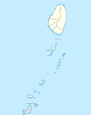
Saint Vincent and the Grenadines lies to the west of Barbados south of Saint Lucia and north of Grenada in the Windward Islands of the Lesser Antilles, an island arc of the Caribbean Sea. The islands of Saint Vincent and the Grenadines include the main island of Saint Vincent 344 km2 (133 sq mi) and the northern two-thirds of the Grenadines 45 km2 (17 sq mi), which are a chain of small islands stretching south from Saint Vincent to Grenada.
The island of Saint Vincent is volcanic and includes little level ground. The windward side of the island is very rocky and steep, while the leeward side has more sandy beaches and bays. The country's highest peak is La Soufrière volcano at 1,234 m (4,049 ft).
Administrative divisions
Administratively, Saint Vincent and the Grenadines is divided into six parishes. Five parishes are on Saint Vincent, while the sixth is made up of the Grenadine islands. Kingstown is located in the Parish of Saint George and is the capital city and central administrative centre of the country.
 Charlotte
Saint George
Saint Andrew
Saint Patrick
Saint David
Grenadines
SAINT VINCENT AND THE GRENADINES
|
Economy


Agriculture, dominated by banana production, is the most important sector of this lower-middle-income economy. The services sector, based mostly on a growing tourist industry, is also important. The government has been relatively unsuccessful at introducing new industries, and the unemployment rate remains high at 19.8% in the 1991 census to 15% in 2001. The continuing dependence on a single crop represents the biggest obstacle to the islands' development as tropical storms wiped out substantial portions of crops in many years.
The tourism sector has considerable potential for development. The recent filming of the Pirates of the Caribbean movies on the island has helped to expose the country to more potential visitors and investors. Recent growth has been stimulated by strong activity in the construction sector and an improvement in tourism.
Argyle International Airport is currently under construction. There is a small manufacturing sector and a small offshore financial sector whose particularly restrictive secrecy laws have caused some international concern. In addition, the natives of Bequia are permitted to hunt up to four Humpback Whales per year under IWC subsistence quotas.
Demographics
The population as established in July 2009 was 104,574. The ethnic composition was 66% African descent, 20% of mixed descent, 6% East Indian, 4% Europeans (mainly Portuguese), 2% Carib Amerindian and 2% others according to the CIA World Factbook de dato 9 October 2008. Most Vincentians are the descendants of African people brought to the island to work on plantations. There are other ethnic groups such as Portuguese (from Madeira) and East Indians, both brought in to work on the plantations after the abolishing of slavery by the British, and Syrians living on the island. There is also a growing Chinese population.
Cultural
Music
Music popular in Saint Vincent and the Grenadines includes big drum, calypso, soca, steelpan and reggae. String band music, quadrille and bele music and traditional storytelling are also popular.
The national anthem of Saint Vincent and the Grenadines is " Saint Vincent Land so Beautiful", adopted upon independence in 1979.
Communications
In 2010, Saint Vincent and the Grenadines had 21,700 telephone land lines. Its land telephone system is fully automatic and covers the entire island and all of the inhabited Grenadine islands. In 2002, there were 10,000 mobile phones. By 2010, this number had increased to 131,800. Mobile phone service is available in most areas of Saint Vincent as well as the Grenadines.
The country has ten FM radio stations including; 89.1 Jem Radio, 89.7 NBC Radio, 95.7 and 105.7 Praise FM, 96.7 Nice Radio, 97.1 Hot 97, 98.3 Star FM, 99.9 We FM, 100.5 First FM, 103.7 Hitz FM, and 104.3 Cross Country Radio. It has one television broadcast station ZBG-TV (SVGTV) and one cable television provider.
The country has Three ISPs, Digicel, Karib Cable and LIME, that provide cellular telephone and internet service.