Imagen:Xinjiang nationalities by prefecture 2000.png
De Wikipedia, la enciclopedia libre

| | Éste es un fichero de Wikimedia Commons, un depósito de contenido libre hospedado por la Fundación Wikimedia. Más abajo se reproduce su página de descripción con la información sobre su origen y licencia. |
[edit] Summary
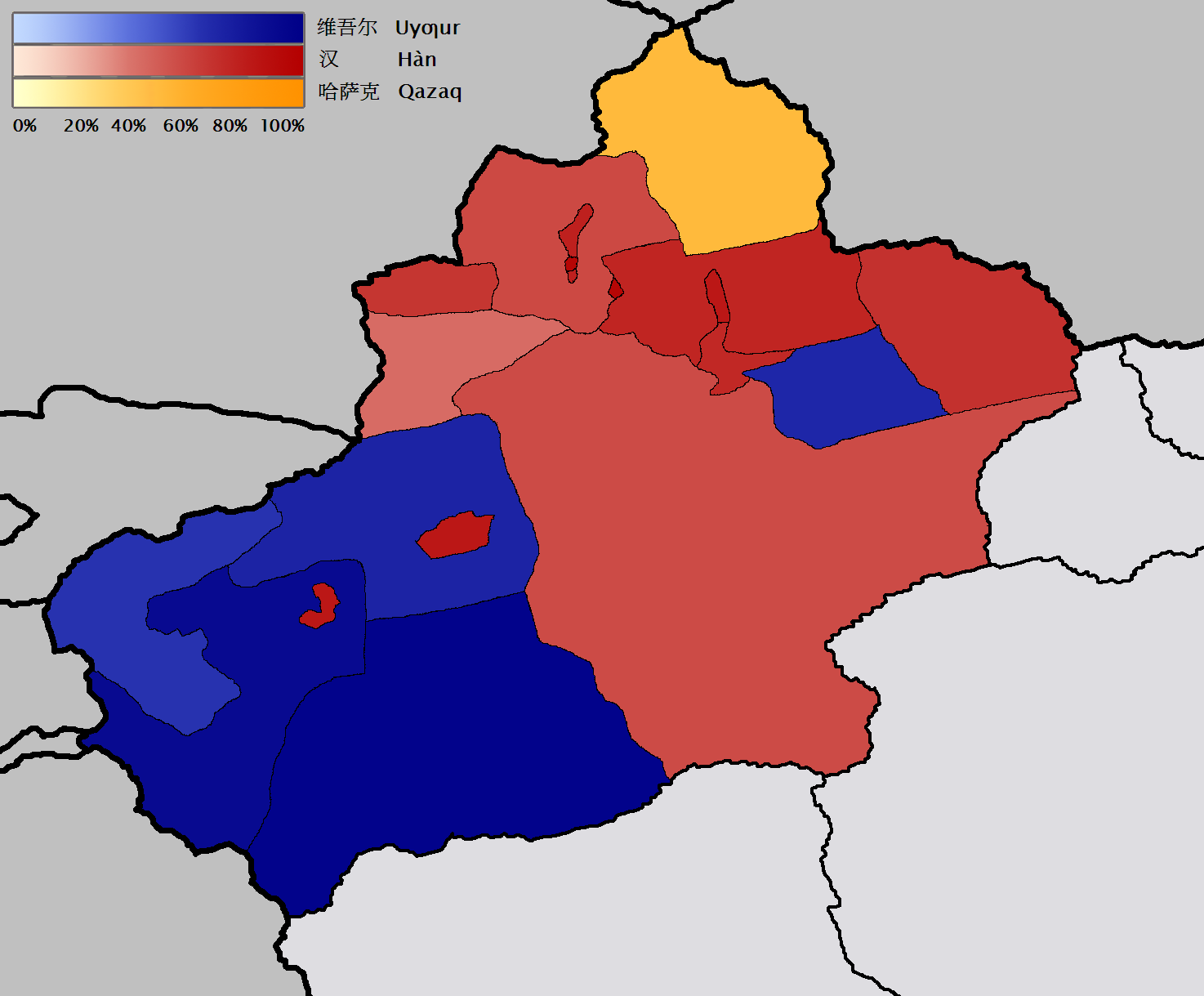
- en: Map of the prefecture-level divisions of Xinjiang by ethnicity (nationality or 民族). 2000 census information is from w:en and w:de. The basis of the map is Image:Bayin Gholin.png, but I rotated the map so that the meridians are more nearly vertical, and also removed the background noise. I borrowed the colour scale from the excellent Image:Canada election 2006 v2.png. QuartierLatin1968 21:20, 28 January 2006 (UTC)
[edit] Licensing
|

Enlaces a la imagen
Las siguientes páginas enlazan a esta imagen:

