
Grafika:Ph locator map palawan.png
Z Wikipedii
Grafika w wyższej rozdzielczości jest niedostępna.
Ph_locator_map_palawan.png (300 × 440 pikseli, rozmiar pliku: 19 kB, typ MIME: image/png)
| | Plik Ph locator map palawan.png [ edytuj opis ] umieszczony jest w Wikimedia Commons, repozytorium wolnych zasobów projektów Fundacji Wikimedia. Wyjaśnienie podanej poniżej licencji znajdziesz na stronie Opisy licencji grafiki. |
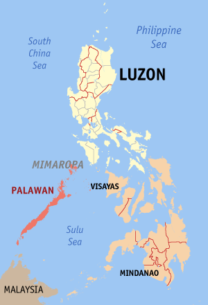
Map of the Philippines showing the location of Palawan.
Created and copyright (2003) by seav. Released under the GNU FDL.

Historia pliku
Kliknij na datę/czas, aby zobaczyć, jak plik wyglądał w tym czasie.
| Data/czas | Wymiary | Użytkownik | Opis | |
|---|---|---|---|---|
| aktualny | 15:53, 30 gru 2005 | 300×440 (19 kB) | Magalhães | (Map of the Philippines showing the location of Palawan. Created and copyright (2003) by seav. Released under the GNU FDL.) |
| 22:45, 18 sie 2005 | 300×450 (15 kB) | Gildemax | (Map of the Philippines showing the location of Palawan. Map of the Philippines showing the location of Palawan. Created and copyright (2003) by en:user:]seav under the GNU FDL. Source: http://en.wikipedia.org/wiki/Image:Ph_locator_map_pal) |
Odnośniki do pliku
Następujące strony odwołują się do tego pliku:

