Conakry
Background Information
SOS Children, an education charity, organised this selection. Sponsoring children helps children in the developing world to learn too.
| Conakry Kɔnakiri |
|
|---|---|
| Conakry, Guinea | |
|
|
|
| Coordinates: 9°31′N 13°42′W | |
| Country | |
| Region | Conakry Region |
| Population (2008) | |
| • Total | 1,931,184 |
| Time zone | CET ( UTC+1) |
| • Summer ( DST) | CEST ( UTC+1) |
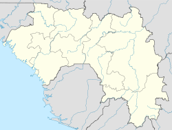
Conakry ( Sosso: Kɔnakiri) is the capital and largest city of Guinea. Conakry is a port city on the Atlantic Ocean and serves as the economic, financial and cultural centre of Guinea with a population of 1,931,184. Originally situated on Tombo Island, one of the Îles de Los, it has since spread up the neighboring Kaloum Peninsula.
The population of Conakry is difficult to ascertain, although the U.S. Bureau of African Affairs has estimated it at 2 million. Even given this uncertainty, Conakry makes up almost a quarter of the population of Guinea.
History
According to a legend, the name of the city comes from the fusion of the name "Cona", a wine and cheese producer of the Baga people, and the word "nakiri", which means in Sosso the other bank or side.
Conakry was originally settled on tiny Tombo Island and later spread to the neighboring Kaloum Peninsula, a 36-kilometer (22 mi) long stretch of land 0.2 to 6 kilometers (660 to 20,000 ft) wide. The city was essentially founded after Britain ceded the island to France in 1887. In 1885, the two island villages of Conakry and Boubinet had fewer than 500 inhabitants. Conakry became the capital of French Guinea in 1904 and prospered as an export port, particularly after a (now closed) railway to Kankan opened the large scale export of groundnut from the interior.
In the decades after independence, the population of Conakry exploded, from 50,000 inhabitants in 1958 to 600,000 in 1980, to over two million today. Its small land area and relative isolation from the mainland, while an advantage to its colonial founders, has created an infrastructural burden since independence.
In 1970, conflict between Portuguese forces and the PAIGC in neighbouring Portuguese Guinea (now Guinea-Bissau) spilled into the Republic of Guinea when a group of 350 Portuguese troops and Guinean dissidents landed near Conakry, attacked the city, and freed 26 Portuguese prisoners of war held by the PAIGC before retreating, failing to overthrow the government or kill the PAIGC leadership.
Government and administration
Conakry is a special city with a single region and prefecture government. The local government of the city was decentralized in 1991 between five municipal communes headed by a mayor. From the tip in the southwest, these are:
- Kaloum – the city centre
- Dixinn – including the University of Conakry and many embassies)
- Ratoma – known for its nightlife
- Matam
- Matoto – home to Gbessia Airport.
The five urban communes make up the Conakry Region, one of the eight Regions of Guinea, which is headed by a governor. At the second-tier prefect level, the city is designated as the Conakry Special Zone, though the prefecture and regional government are one and the same. At two million inhabitants, it is far and away the largest city in Guinea, making up almost a quarter of the nation's population and making it more than four times bigger than its nearest rival, Kankan.
Economy
Conakry is Guinea's largest city and its administrative, communications, and economic centre. The city's economy revolves largely around the port, which has modern facilities for handling and storing cargo, through which alumina and bananas are shipped. Manufactures include food products and Housing Materials. An average Guinean in Conakry will get a monthly wage of about 225 000 GNF or about $45.
Infrastructural crisis
Periodic power and water cuts are a daily burden for Conakry's residents, dating back to early 2002. Government and power company officials blame the drought of February 2001 for a failure of the hydro-electric supply to the capital, and a failure of aging machinery for the continuation of the crisis. Critics of the government cite mis-management, corruption, and the pull out of the power agency's French partner at the beginning of 2002. As of 2007, much of the city has no traffic lighting in the overnight hours. Popular anger at shortages in Conakry was entwined with anti-government protests, strikes, and violence over the rule of President Lansana Conté and the successive prime ministers, Cellou Dalein Diallo and Eugène Camara, appointed to fill the post after the resignation of Prime Minister François Lonseny Fall in April 2004. Violence reached a peak in January-February 2007 in a general strike, which saw over a hundred deaths when the Army confronted protesters
Climate
According to Koppen climate classification, Conakry features a Tropical monsoon climate. Conakry features a wet season and a dry season. Like a good portion of West Africa, Conakry's dry season is influenced by the harmattan between December and April. As a result relatively little precipitation falls in the city during these months. However, unlike a good portion of West Africa, Conakry's wet season sees an extraordinary amount of precipitation. As a result, Conakry averages nearly 4,300 mm (169 in.) of precipitation per year, earning the city a tropical monsoon climate classification.
| Climate data for Conakry | |||||||||||||
|---|---|---|---|---|---|---|---|---|---|---|---|---|---|
| Month | Jan | Feb | Mar | Apr | May | Jun | Jul | Aug | Sep | Oct | Nov | Dec | Year |
| Source: BBC Weather | |||||||||||||
Attractions
Attractions in the city include the Guinea National Museum, several markets, the Guinea Palais du Peuple, Conakry Grand Mosque (which was built by Ahmed Sékou Touré), the city's nightlife and the nearby Iles de Los.
The city is noted for its botanical garden. The Polytechnical Institute of Conakry is also located in Conakry.
The street numbering scheme of Conakry labels all roads with a two-letter code for the urban district, followed by a three digit number: odd for north-south streets and even for east-west, e.g. KA002 for a northbound street in the Kaloum district.


